

Maps
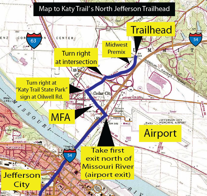
Map to North Jefferson City Trailhead Trail Map from North Jefferson City
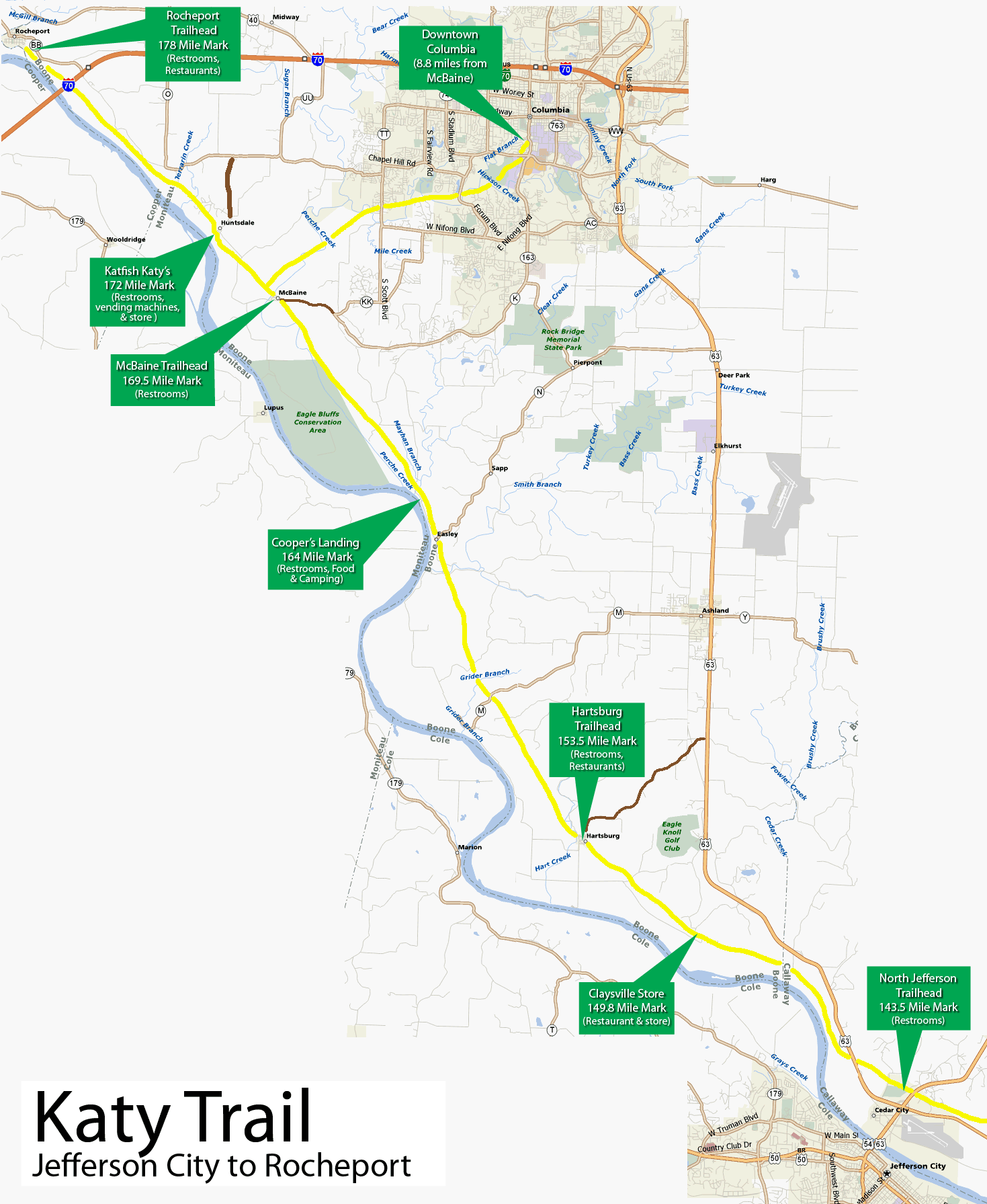
to Rocheport and Columbia
The Katy Trail is a great place for cycling, hiking and running for people of all ages. It's flat and offers views of the Missouri River, rock bluffs, farmlands wetlands, wildlife, etc. The trailhead nearest to the Lake of the Ozarks is located just north of Jefferson City, across the Missouri River.
Be sure to bring food, water, tire tubes (or repair kit), CO2 cartridges, a multitool, etc., as availability of essential items is very limited--and virtually unavailable during the off season. Other suggested items would be a first aid kit and a bike lock. Cellphone service is spotty.
Mountain or hybrid bikes with wide tires are best for the trail. Road bikes with narrow tires are definitely not recommended. The trail consists mostly of hard-packed gravel. However, there are some sections with loose gravel, and on these sections, wide tires are necessary. Be sure to wear a helmet and eye protection.
From the Jefferson City trailhead, the better direction to travel is west, since it offers much more to see and more services.
Some suggested trips, with round-trip mileage to Jefferson City, are:
Jefferson City - Hartsburg 19 miles
Jefferson City - McBaine 52 miles
Jefferson City - Rocheport 70 miles
Jefferson City - Columbia 70 miles
Jefferson City to Rocheport, return to McBaine, turn north to Columbia, return to Jefferson City 88 miles
For much more detailed information about the Katy Trail State Park, be sure to check out http://bikekatytrail.com/ and http://www.mostateparks.com/katytrail/index.html